Impact of Climate Change on Agricultural Land Use
As of March 2026, climate change is no longer a distant threat to agricultural land use; it is a primary driver of geopolitical and economic reallocation. Research from the FAO, OECD, and various 2026 climate risk briefings indicates that we are witnessing a “Polarization of Suitability,” where the global map of productive land is being redrawn.
Here is the breakdown of how climate change is impacting agricultural land use in 2026.
1. The Great Latitudinal Shift
The most significant trend of 2026 is the migration of “prime” agricultural zones toward the poles.
- Winners (The Northern Expansion): Higher latitudes in Canada, Northern Europe, and Russia are seeing a 15%–20% increase in land suitable for arable farming. However, these “new” lands often lack the infrastructure (roads, silos, irrigation) of established breadbaskets.
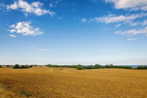
- Losers (The Tropical Decline): Low-latitude regions, particularly in Africa and Asia, are projected to lose up to 22% of their suitable wheat-growing land by 2026 due to extreme heat stress and erratic rainfall.
- The Breadbasket Volatility: Traditional hubs like the U.S. Midwest and Southern Europe are facing “Aridification,” causing a shift from water-intensive crops (maize, soy) to drought-resistant small grains or permanent grasslands.
2. Carbon Pricing as a Land-Use Driver
In 2026, the cost of carbon has become a functional constraint on how land is used. With carbon prices reaching record highs (exceeding $140 per ton in some markets), farmers are making economic decisions based on emissions:
- Incentivized Conservation: Many farmers are converting marginal arable land into Carbon Sinks (forests or permanent pastures). This “Carbon Farming” is often more profitable than low-yield cropping in 2026.
- Input-Driven Shifts: High carbon taxes on nitrogen fertilizers have made energy-intensive crops like corn 27% more expensive to produce, leading to a reallocation of land toward legumes and sunflowers.
3. Coastal and Steep-Slope Vulnerability
New data from early 2026 highlights specific geographic risks that are often overlooked:
| Land Type | 2026 Climate Threat | Land Use Impact |
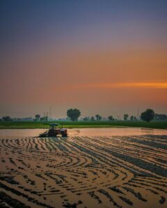
| Coastal Deltas | Seawater Intrusion | Intense salinization is rendering once-productive rice deltas in SE Asia unusable, forcing a shift to aquaculture or salt-tolerant varieties. |
| Steep-Slopes | Shifting Arid Zones | Highland farming systems are being disproportionately affected by expanding arid zones, threatening food security in mountainous regions. |
| Peatlands | Rewetting Mandates | Governments are increasingly mandating the “rewetting” of agricultural peatlands to stop CO2 release, effectively removing this land from traditional crop use. |
4. Adaptation: The Rise of “Resilience Corridors”
To combat these shifts, 2026 has seen the emergence of Resilience Corridors—transnational agreements (like the Addis Ababa Reaffirmation) designed to manage shifting land use.
- Climate-Smart Mobility: In East Africa, “mobility corridors” are being established to allow pastoralists to move livestock across borders as grazing lands shift with changing rainfall patterns.
- Integrated Systems: Brazil and Australia have scaled Integrated Crop-Livestock-Forestry (ICLF) systems. By combining trees with crops, farmers are reducing soil temperatures by up to 5°C, effectively “buying back” land suitability that would otherwise be lost to heat.