Role of Remote Sensing and GIS in Land and Crop Research
Gemini said
In March 2026, Remote Sensing (RS) and Geographic Information Systems (GIS) have moved from being experimental tools to the “digital eyes and brain” of agricultural research. In regions like Faisalabad, which serves as a global hub for textile and agricultural exports, these technologies are critical for managing water scarcity, heat stress, and urban encroachment.
As of March 9, 2026, the integration of AI-driven satellite analytics and local geospatial modeling is transforming how land and crops are managed.
1. Remote Sensing: The “Digital Eyes” of the Field
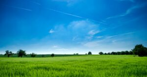
Remote sensing allows researchers to “see” invisible biophysical and biochemical changes in crops without physical contact.
- Early Stress Detection (Beyond NDVI): While the Normalized Difference Vegetation Index (NDVI) remains a baseline, 2026 research has shifted toward Sun-Induced Fluorescence (SIF) and Red Edge (NDRE) indices. These allow researchers at institutions like the University of Agriculture Faisalabad (UAF) to detect temperature and moisture stress days before it becomes visible to the human eye.
- Thermal Mapping: Satellite sensors (like MODIS and Sentinel-2) are being used locally to map “Thermal Anomalies.” In districts like Jhang and Faisalabad, this helps identify high-risk zones for crop failure during heatwaves.
- Hyperspectral UAVs: Drones equipped with hyperspectral sensors can now identify specific nutrient deficiencies (Nitrogen, Phosphorus) or the early onset of pests like whitefly, allowing for targeted “spot-treatment” instead of blanket spraying.
2. GIS: The “Digital Brain” for Spatial Logic
GIS provides the framework to store, analyze, and visualize the massive data streams provided by remote sensing.
- Drought Vulnerability Modeling: Current 2026 research in Faisalabad uses a Multi-Indices Geospatial Framework. By overlaying rainfall data (SPEI) with vegetation health (NDVI) and land surface temperature (TCI), researchers have created “Resilience Maps.” For example, 74% of the Faisalabad division is currently classified as low-risk due to robust canal irrigation, while 6% remains high-risk.
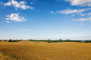
- LULC (Land Use Land Cover) Change Detection: GIS is the primary tool for tracking Urban Sprawl. Recent analysis shows that Faisalabad has lost approximately 13.42 km² of vegetative cover to urban growth, while simultaneously seeing an increase in agricultural intensification in protected greenbelts.
- Groundwater Governance: Researchers use GIS to map groundwater salinity and depth. This allows for the creation of “Precision Irrigation Zones,” where water allocation is adjusted based on the specific recharge capacity of the local aquifer.
3. Key Research Applications in 2026
The synergy between RS and GIS (often called the 3S Technologies including GPS) is delivering measurable insights in the following areas:
| Research Domain | Role of RS/GIS | 2026 Outcome |
| Yield Forecasting | Modeling canopy cover and growth patterns across large districts. | Accuracy of harvest predictions has improved by 15–20% compared to 2020. |
| Climate Adaptation | Simulating crop growth under various temperature and rainfall scenarios. | Identifying “Climate-Smart” seed varieties that thrive in specific sub-regional microclimates. |
| Pest/Disease Tracking | Spatial mapping of outbreak “hotspots.” | Enables “Dynamic Quarantine” zones, preventing the spread of diseases like wheat rust. |
| Precision Nutrition | Overlaying soil maps with real-time vegetation indices. | Reduction in fertilizer waste by up to 30% in pilot smart-farms. |
4. Local Spotlight: Faisalabad Research Hub
As of March 2026, the University of Agriculture Faisalabad (UAF) has established an Agricultural Remote Sensing Lab. Key ongoing projects include:
- Intelligent Crop Monitoring: A cooperative project for overseas applications of intelligent crop monitoring using remote sensing.
- Drought Mitigation Plans: Using Google Earth Engine (GEE) to provide real-time, cloud-based monitoring for provincial water governance.